The Yampa River Valley, located in the Northwest corner of Colorado, hosts critical sagebrush habitat that supports wildlife and livestock. In this arid region, water resources hold disproportionate importance, with low-lying wet meadows providing essential sources of diverse forage (Rondeau et al., 2023). As such, wet meadows often fall under private ownership for agricultural purposes, presenting unique conservation and restoration opportunities though land owner partnerships. Trusted community non-profits, including the Colorado Cattlemen’s Agricultural Land Trust (CCALT), are uniquely positioned to engage working landowners in conservation while helping them reach their management goals. This year, we focused on strengthening collaborative opportunities through additive conservation. CCALT defines additive conservation as projects that improve both ecological and operational processes, building on the permanent protection of working lands through conservation easements.
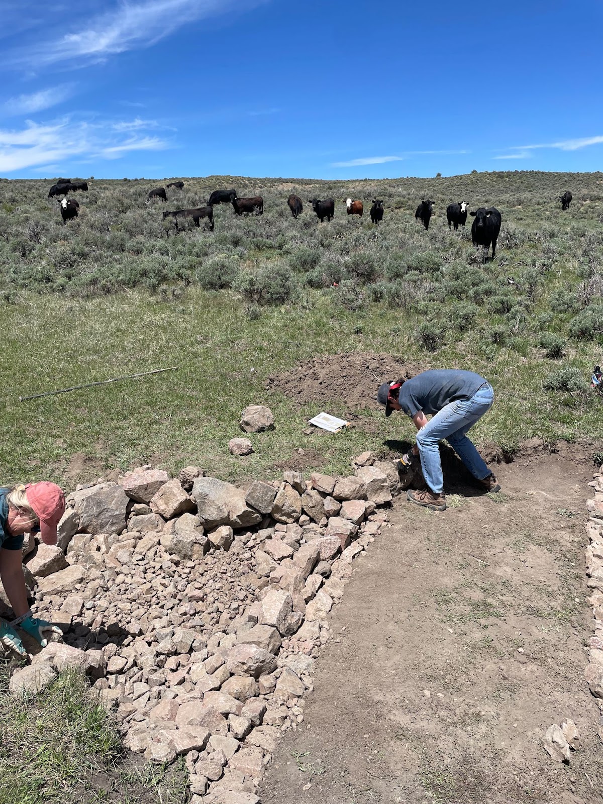
Wet meadows are susceptible to drainage challenges that cause erosion and vegetation loss, compromising available forage for wildlife and livestock. The best solution to these erosion problems could be right in front of us. Surmounting research shows that erosion can be limited, allowing for revegetation, by installing simple log and rock structures. Materials can often be sourced directly from the property, keeping implementation costs low. Because of the simplicity of materials, form, and long-term durability, overall costs for projects are relatively low.
Effects of these structures on degraded wet meadow sites include increased hydrologic function, increased mesic vegetation cover, improved soil quality, and decreased sediment loss (Norman, 2022). The report we authored for CCALT aimed to delineate these benefits into categories that are easily captured by low cost monitoring techniques. However, due to the interconnected characteristics of soil, water, and life, there are distinct challenges to isolate benefits into discrete groups.
Throughout the project, monitoring posed one of the greatest areas for consideration. Our two monitoring goals were as follows: (a) capture the benefits of the introduced rock/log restoration structures to wet meadows and (b) maintain low-cost and user-friendly monitoring techniques. Guided by these goals, we identified low cost, accessible, and meaningful monitoring methods to capture habitat changes.
Photopoints:
Photopoint monitoring captures changes in a habitat through photographing the same place over an extended time period. For landowners, the NRCS recommends this method to capture wet meadow restoration because it captures through simple equipment.
Vegetation Surveying:
Vegetation surveys offer another tool to capture changes after site restoration. These surveys can focus on changes in overall amount of vegetation (though biomass estimates) and/or variety of plants present (species diversity). Plant surveying may require some background vegetation knowledge. However, we still identify this viable method because working landowners often have robust backgrounds in local ecology. To support any gaps, there are ample open-access sagebrush and wet meadow identification guides. From this research, there are further opportunities to develop a vegetation monitoring guide for landowners.
Soil Monitoring:
Broadly, soil monitoring can include a variety of methods used to capture characteristics of soil such as nutrients, water content, texture, and more. Specific to wet meadow restoration, soil monitoring can be used to measure changes in organic material, microbial presence, soil water, and density. To support landowners,Colorado State University offers low-cost scientific testing, making soil sampling especially accessible.
Captured Sediment Estimates:
Wet meadow rock/log restoration structures primarily control erosion through re-stabilizing soil. Before implementation, indicators of erosion include loss of vegetation, sediment deposits, channelization, and head cutting. After implementation, sediment should settle and deposit at the site of the structure. To measure this, one could develop volume based estimates of re-captured sediment and/or the prevented loss of sediment resulting from the restoration intervention.
This short list of monitoring methods does have limitations. Most provide limited precise, qualitative data. Further, while these methods intend to capture changes as a result of restoration interventions, none present a way to separate restoration-related measures from variables like precipitation, temperature, and grazing. Despite these limitations, these low-cost and accessible methods capture important and intended outcomes resulting from restoration.
The question is, do these methods provide enough evidence of the impacts resulting from wet meadow restoration structures? From our research, we are inclined to say yes, at least for our purposes. In conservation we can become easily fixated on quantifying exactly what is changing. To do this, if at all possible, can require extensive technical, financial, and knowledge resources. This can greatly compromise the accessibility of monitoring.
We are choosing to prioritize accessibility which may result in some compromise of precision. However, our answer, yes, is also supported by existing research that provides strong and consistent evidence of the positive effects of these structures (Norman et al., 2015; Gooden & Prizladd, 2021; Uhlman et al., 2021; Wilson & Norman, 2018).
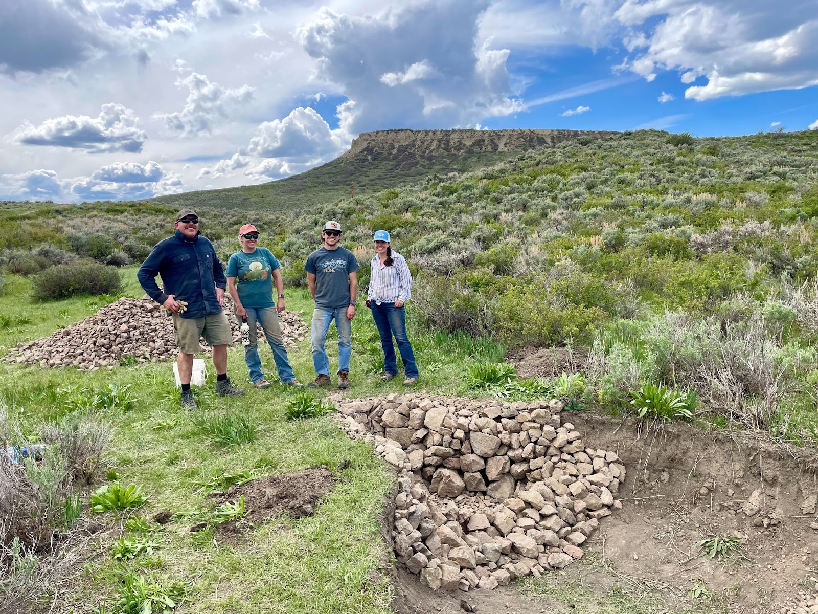
Importantly, what is missing in this post and our report is in-the-field trials. Ultimately, monitoring must be informed and refined based on the habitat itself. CCALT is moving towards pilot monitoring processes of wet meadow restoration projects with participating landowners. Feedback from these landowners and the landscapes they steward will provide invaluable information to CCALT of how to monitor these projects and account for the ecosystem services they accrue.
For more information regarding monitoring, costs, and benefits of wet meadow restoration rock structures, refer to our report (add hyperlink) in partnership with Colorado Cattlemen’s Agricultural Land Trust.
**All site photos provided by CCALT (Spring 2024)
Citations
Gooden, J., & Pritzlaff, R. (2021). Dryland watershed restoration with rock detention structures: A nature-based solution to mitigate drought, erosion, flooding, and atmospheric carbon. Frontiers in Environmental Science, 9, 679189.
Norman, L. M. (2022). Commentary: Dryland watershed restoration with rock detention structures: A nature-based solution to mitigate drought, erosion, flooding, and atmospheric carbon. Frontiers in Environmental Science, 10, 853684.
Norman, L. M., Brinkerhoff, F., Gwilliam, E., Guertin, D. P., Callegary, J., Goodrich, D. C., Nagler, P. L., and Gray, F. (2015) Hydrologic Response of Streams Restored with Check Dams in the Chiricahua Mountains, Arizona. River Res. Applic., 32: 519–527. doi: 10.1002/rra.2895.
Rondeau, R.J., Austin, G., Miller, R.S., Parker, S., Breibart, A., Conner, S., Neely, E., Seward, N.W., Vasquez, M.G. and Zeedyk, W.D. (2024), Restoration of wet meadows to enhance Gunnison sage-grouse habitat and drought resilience in arid rangelands. Restor Ecol, 32: e14039. https://doi.org/10.1111/rec.14039
Uhlman, K., Eastoe, C., Guido, Z., Crimmins, M.A., Purkey-Deller, A. and Eden, S. (2020), Assessing the Vulnerability of an Aquifer to Climate Variability through Community Participation in Arivaca, Arizona. Journal of Contemporary Water Research & Education, 170: 2-18. https://doi-org.yale.idm.oclc.org/10.1111/j.1936-704X.2020.03337.x
Wilson, Natalie R. & Norman, Laura M. (2018) Analysis of vegetation recovery surrounding a restored wetland using the normalized difference infrared index (NDII) and normalized difference vegetation index (NDVI), International Journal of Remote Sensing, 39:10, 3243-3274, DOI: 10.1080/01431161.2018.1437297