Two team members recently attended the annual Northeast ArcGIS User’s Conference to present research tied to the High Plains. A poster (below) covered findings associated with the latest manuscript submitted for peer review. It was formally presented during an evening social and on display for several days. A “lightning talk” (20 slides that auto-advance over 5 minutes!) was given on using a portable spectrometer to capture electromagnetic signatures, followed by the integration of those signatures into Google Earth Engine. Both presentations were well received and provided an opportunity to share our findings with folks outside of the High Plains region.
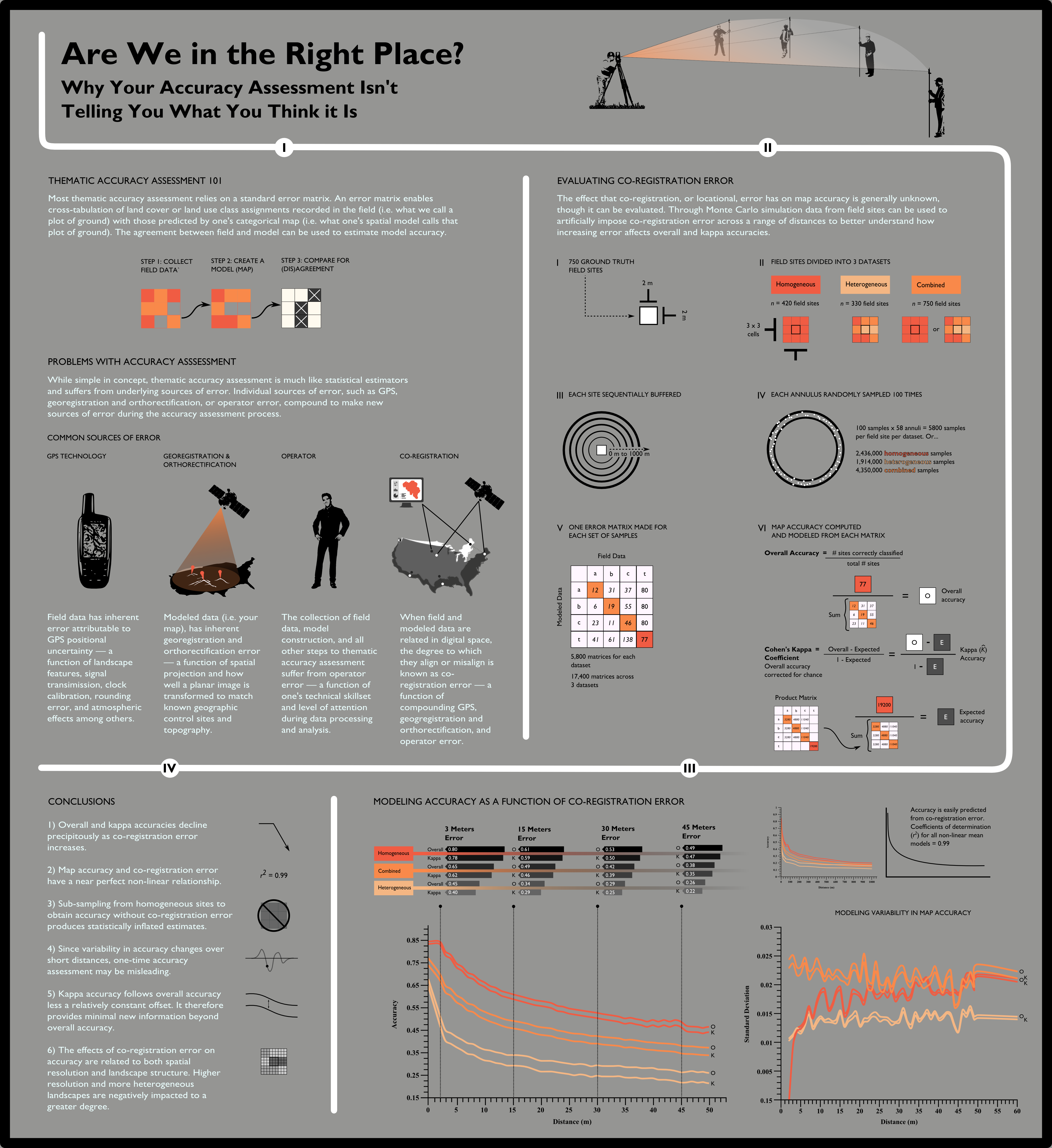
A poster detailing the effects of co-registration error between GPS technology and satellite imagery on categorical map accuracy.