STUDENT RESEARCH – Explore graduate/undergraduate projects through blog posts, reports, and maps…read more
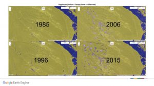
SAGETRENDS – SageTrends is a landscape scale monitoring platform, that uses the latest in cloud computing and machine learning to map sagebrush distribution over large areas on an annual basis over the past 30 years…read more
Quick Carbon – Quick Carbon is a novel method for measuring and mapping soil organic carbon using inexpensive portable spectrometry. With strong correlations between spectral readings and laboratory carbon analysis, the Quick Carbon team is able to build soil maps at large spatial extents and fine spatial resolutions at a fraction of the cost and time of conventional lab-based methods…read more
CVA – In the West, rangeland parcels tend to be large, remote, and difficult to access. The ability to understand nuances of landscape change, in particular the changing proportions of barren land and vegetative productivity across these large parcels, is instrumental in allowing land managers to understand the benefits of historic management decisions and in planning for a more effective future. Our change vector analysis provides exactly this capacity – anyone with an internet connection can create cartographic, tabular, and plot-based results that illustrate the magnitudes and direction of change between two dates or across multiple pairs of dates…read more
LAND COVER • Land cover refers to that which is covering the ground at any given location, and is not to be confused with land use, or how a landcover functions from an anthropocentric point of view. Land cover is a landscape attribute that plays a major role in supporting all levels of the food chain, adding organic matter to soil, decreasing erosion, improving soil water retention, sequestering carbon, and guiding human livelihoods, among others. UHPSI has devoted considerable time to analyzing and developing maps of ranch-wide land cover, as well as to evaluating the accuracy of those maps. Read more…>>
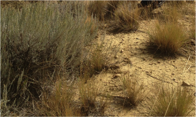
INVASIVE SPECIES • Invasive species are flora and fauna that are not endemic to a given area, and for which there are often poor biological mechanisms to control their spread and influence. Such species are commonly characterized by aggressive behavior, often flourishing under conditions where native flora and fauna do not, in turn displacing native varieties. On the Ucross Ranch, it is impossible to monitor all locations for damage or infestation from invasive species. This is why UHPSI uses a combination of field research and satellite imagery analysis to address the spread of invasives such as leafy spurge. Read more…>>
