Default title
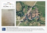
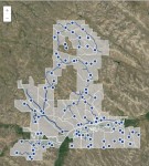
We’ve been playing around with a number of methods for sharing our spatial data. Star has been working with CartoDB – an open-source, cloud-based, spatial database – for some of his urban planning work. Check out this map of pastures and watering holes at Ucross. The delineation of pastures and watering holes was one of Read more about Default title[…]